Services
Scanning
Photogrammetry
Customization
Scanning
We not only sell ScanLook but we are proud to say that we will also provide the scanning as a service. Jobs for static or mobile scanning, imagery only, or any combination of these are perfectly acceptable. Most survey grade jobs have nationwide competition due to the expense of the MMS. We think ScanLook will change that with most jobs being done easily within one or two hours of driving distance. We think this will open up a much larger client base for MMS data – many of the one or two mile jobs, even sub-division topos, will trend towards MMS data rather than conventional surveys or static scans. We will continue to offer scanning as a service as long as there is a market demand. It will keep us sharp and guarantee a product that improves as well. Additionally it means we will be doing real world testing on everything we release. If you’ve ever been part of a beta program for any product you soon find out that there’s a lot of uncertainty involved. We think you should get what you pay for today, not at some nebulous tomorrow. We can provide sample data for those interested. Be sure to check out our Downloads page for recent postings of data you can download and test. Naturally we also provide static scanning often for indoor projects (BIM, caves, tunnels, etc.) or for areas with no GPS.
Scanning services can be used for:
Roadways (design and analysis)
Bridges clearances
Utilities (Encroachments, Clearances, Inventory, Inspection)
Signage (Location, Inventory, Reflectivity)
Guardrails (Location, Inventory, Assessment)
Railway (alignment, asset inventory)
Tunnels
Accident Reconstruction
Agriculture
Forestry
Geology
Wildlife (nesting, topo)
Survey
Streetview Imagery
Gaming
Oil & Gas
To list just a few uses of our scanning services.
Photogrammetry
Not to be left out, we have long been providing photogrammetry services, consulting, training, and software. Jeff was one of the key software developers for the Intergraph series of photogrammetric instruments starting in 1985 (IMA, IMD, IMZ). His particular emphasis was on data management and triangulation.
Aerial Triangulation is our primary area of service for photogrammetry. We use ISAT for all measurements and SYD (our own tool) for data management, project setup, output, interfacing, etc.
Virtually every end solution passes through BINGO for a complete AT analysis and to get highly reliable results in all cases. BINGO can handle almost any type of camera system. In fact, we use BINGO to calibrate ScanLook’s cameras.
We have a collection of our own tools to eliminate hours of work for any given job. These include (SYD – Something You Do), GraphAT, AGPS Station Finder and a few others.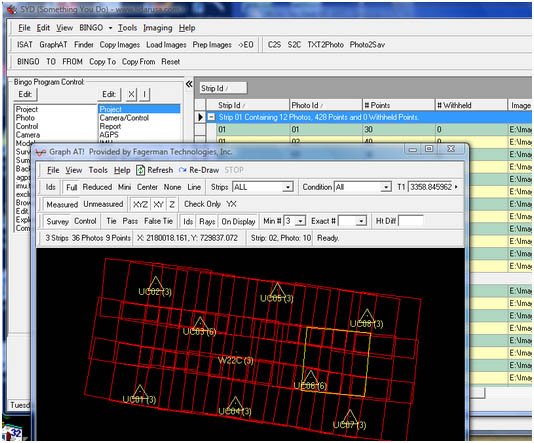
Customization
We also entertain customization of ScanLook for a variety of other unconventional purposes (and there are some really amazing uses of the data).
Other scanners can also be included.
The limit here is imagination and availability of time.